
From Point Cloud to Site Model: How Quality Was Checked on Project 385.UK
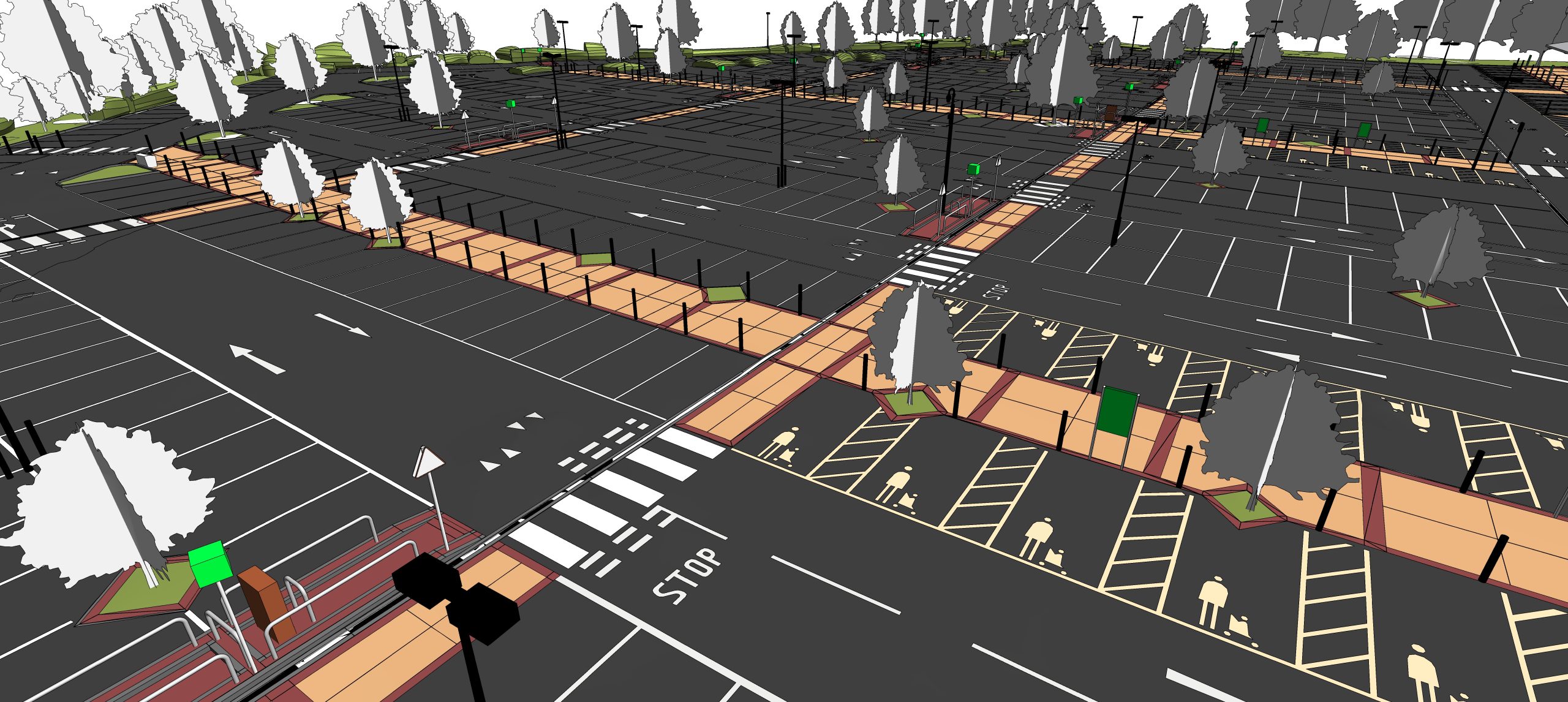
Delivering a big model is one task. Proving it is accurate is another. This note focuses on the verification side of Project 385.UK, a 43,000 m² topographic Revit model in the United Kingdom, delivered by ViBIM from a point cloud and existing 2D drawings.
The accuracy target
The project set a strict modeling tolerance of ±25 mm. The model had to follow the point cloud closely while still being a clean, usable Revit model. Architecture and structure were built to LOD 300, and MEP to LOD 200.
Terrain work like this sits under topography BIM modeling, but the site also included roads, drainage and MEP, so the checks had to cover far more than the ground surface. The full record of inputs, software and deliverables is on the project page, Revit modeling for topographical site in the UK.
Step 1: Control the size of the problem
Checking accuracy is hard when one file holds an entire site. The team divided the terrain into smaller independent sections. Each section could be modeled and checked on its own, then joined with its neighbors into one seamless surface. Smaller units meant faster checks and fewer surprises at the stitching stage.
Step 2: Compare model and scan directly
Specialized software was used to compare the BIM model against the source point cloud. This deviation analysis reviews every modeled object, so errors surface as numbers rather than impressions. All components stayed inside the ±25 mm tolerance.
Step 3: Check what the scan cannot show
Some details do not live in point cloud geometry alone:
- Structural composition was verified by combining detailed cross-sections in the model with dedicated component inspection software.
- Arrows and road markings were resolved by triangulating the point cloud, TrueView imagery and satellite maps for correct color and position.
- Materials were assigned by cross-referencing client photographs and Google Maps.
Step 4: Keep the data usable
A large site needs a lot of custom families. An internal tool was used to batch-load them, which kept the schedule steady. Pavements and terrain carry separate materials, so quantity takeoffs and material management work from the same model.
Result
The delivered Revit file is a definitive as-built reference for the site. Teams planning renovation or asset management can rely on measured geometry and a documented verification process. For anyone scoping similar ground and infrastructure work, ViBIM's topography BIM modeling service is the place to start.